To Contact Me
Latest News

Latest News
Latest News
Latest News
Latest News

Latest News

Latest News

Latest News

Latest News

Latest News

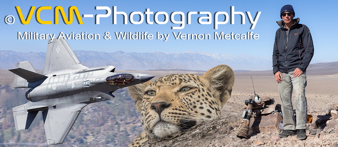
Welcome to VCM-Photography, a website designed and written
by myself Vernon Metcalfe to showcase my photographic passion for
military aviation and wildlife.
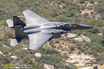
My aviation photography is orientated towards the dynamic aspect of military low flying,
where aircraft are captured flying landlocked against the countryside, rather than
airshow photography, where aircraft are captured against the sky.
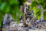
My parallel passion is wildlife photography, encompassing all species, but with a preference
for the ‘Big Cats’, which has taken me to places such as India, looking for the
elusive tiger, Africa for the lion, leopard and cheetah and to the Brazilian Pantanal for the
iconic jaguar.
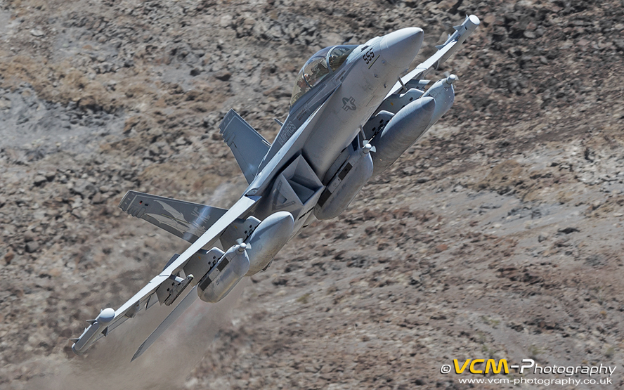 Boeing EA-18G Growler low-level in the Jedi Transition. California, U.S.A.
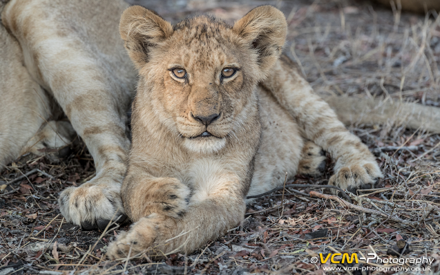 Nkuhuma Pride, lion cub. Sabi Sands, South Africa.
All applicable copyright laws pertain to all content on this site. Downloading, hot‑linking, copying and/or distribution (by print, electronic media or other means) is strictly prohibited. If you wish to purchase high quality images, or use any images for personal or commercial use please email: vcmetcalfe@btinternet.com
In May, accompanied by my wife, I had a photography trip to California. My planned itinerary was a mixture of military aircraft
crash site wreck hunting and photographing low flying military aircraft on the Sidewinder low‑level military training route
in the Owens Valley and Kern River Valley.
Friday 15th ‑ Our planned itinerary was an early‑morning domestic flight from Scotland down to London Heathrow
where we would catch a 14:20 international flight to California, arriving into Los Angeles at 18:40 the same day. We had booked
our accommodation for the first night at the Hilton Los Angeles Airport and to pick up a hire car on the Saturday morning at 08:00.
On the Saturday we had planned to visit a couple of crash sites in the Mojave desert whilst making our way to Barstow where we had a motel
booked for our second night.
On Thursday 14th British Airways informed us that our domestic flight had been cancelled and they had rescheduled us onto a later flight.
This meant at Heathrow we had a short connection of approximately 1.5 hours till the planned departure of our international flight. Normally
this would not be an issue as we try and travel light only carrying hand luggage, but on this trip we had hold luggage. Even a short delay
of our flight departing from Scotland meant there was a strong possibility that our luggage would not make the connection. If our luggage
did not make the connection it would put the kibosh on our plans, as we were carrying hiking equipment which we needed for the first few
days of our holiday.
This problem faded into obscurity on Thursday evening when British Airways informed us that our international flight to Los Angeles had been
cancelled due to a technical issue and they had rescheduled us onto a flight departing Heathrow on Saturday the 16th at 08:20. To cut
a long story short we had to fly down to Heathrow on the Friday evening and stay over at the Heathrow Sofitel to make the Los Angeles flight
Saturday morning. A little bonus (being an aviation geek) was that the flight down from Scotland was on the British Airways operated
Airbus A319 (registration G‑EUPJ) adorned in the iconic British European Airways (BEA) Red Square livery, which had
originally been introduced in 2019 for the airline's centenary celebrations.
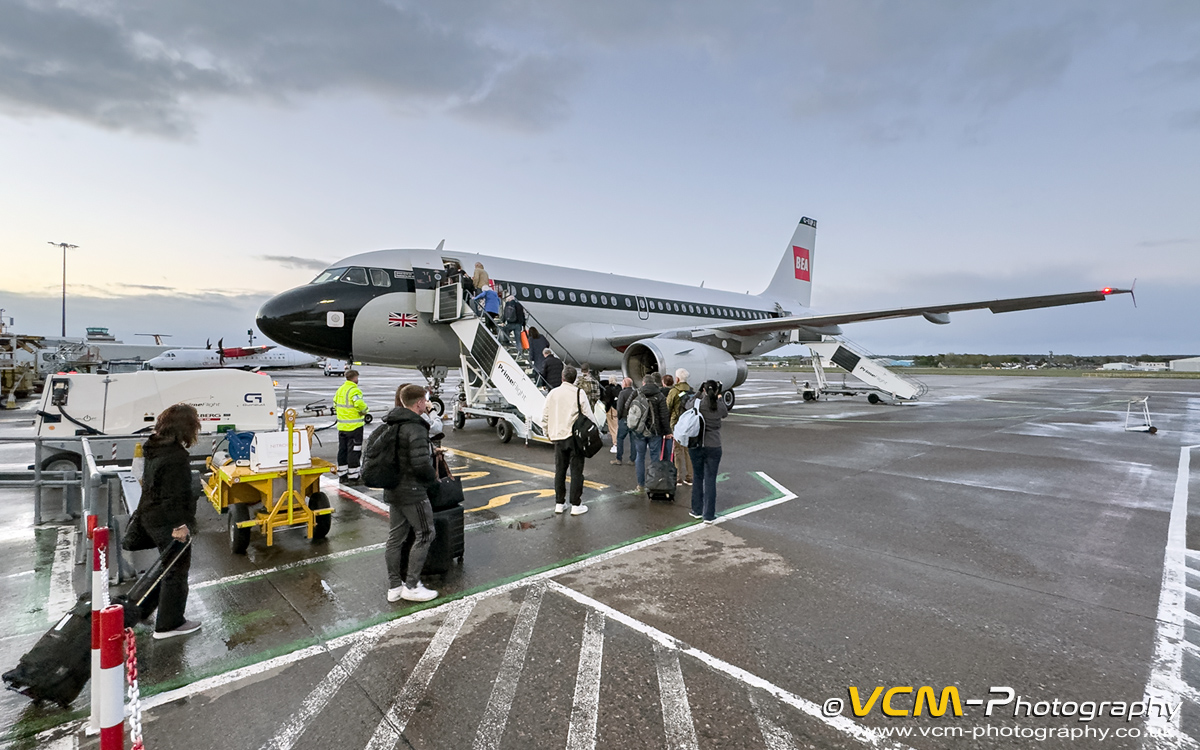 British Airways Airbus A319 adorned in BEA Red Square livery.
Our next headache was the car hire. We had scheduled to pick up the vehicle on Saturday morning at 08:00. Normally they have a grace
period of a couple of hours and if you are a no‑show they will cancel it. I was still a little raw from the experience we had when
we visited the National Museum of the USAF in Dayton, Ohio last year. Due to flight problems we arrived a day later than planned, and because
it was near‑impossible to contact Expedia who the booking was through, the car hire company cancelled our booking, so we had to take out
a new hire at our own cost. What I can't get my head around with this policy is that you have paid for the car so it should be kept
on‑hold for the duration of the hire. I certainly won't be using Expedia again. I now make a policy of booking directly with a
car hire company or hotel through their own websites.
The aircraft crash sites we planned to visit can be accessed by off‑highway vehicle (OHV) routes, so I had hired a Jeep Wrangler
as I wanted a vehicle with high ground clearance, substantial tyres and 4‑wheel drive. Our flight was scheduled to arrive into Los Angeles
at 11:30, so by the time we cleared immigration, picked up our luggage and caught the shuttle bus to the car hire rental, we would not
arrive at the centre till at least 13:00, so I was concerned they might cancel our booking, and then there was no guarantee we would be able
to get a Jeep Wrangler. On Friday evening after we checked into the LHR Sofitel we managed to download the car hire mobile app and inform them
of our flights scheduled arrival time. There was nothing more we could do, so now it was in the lap of the gods.
Saturday 16th ‑ After all the trauma of the delayed and cancelled flights the journey went without a hitch. Arriving in the
immigration hall at Los Angeles International Airport we only had to wait in the passport control queue for about ten minutes till we were called
forward to the immigration desk. The immigration officer was friendly, polite and made us feel really welcome which was a positive after all the
negative publicity that had been banded about on the news and social media about travelling to America. Entering the Baggage Claim hall
our luggage was there waiting on the carousel, and after exiting the terminal we only had to wait minutes for the car hire shuttle bus.
After a ten‑minute drive to the new car hire complex we were at the pick‑up desk barely ninety minutes after our flight touched down
at LAX.
The Jeep Wrangler was waiting for us and the desk clerk even made a joke that it was pink. Thankfully it was red. We picked the car up only
five hours later than we had originally planned, but instead of arriving at the car hire centre refreshed after a good nights sleep, we arrived
after a nine‑hour international flight, and now we had to contend with driving out of Los Angeles on the very busy highways. But we
managed it with no issues.
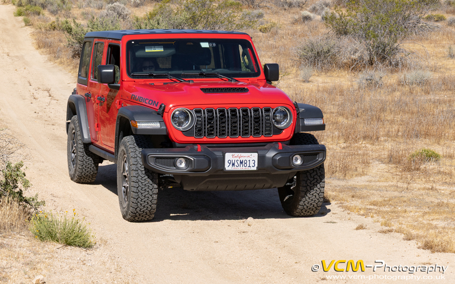 Jeep Wrangler Rubicon hire car.
Today we had planned to visit the crash site of a B‑24 Liberator, S/N. 42‑50780 located in the Mojave Desert north of Boron, and to pay another visit to the Bell X‑2 which I visited in May 2025 (see Trip Report May 2025). During my last visit to the Bell X‑2 the weather had been overcast and windy with gusts blowing sand and debris around. I captured some photos of the Bell X‑2 memorial but had not been happy with the results, so I always intended to visit again when the conditions were more favourable. When we reached the Mojave Desert it was getting late in the afternoon and I was beginning to feel tired after all the travelling. It was a four‑mile drive to the B‑24 along unknown OHV routes, which I felt would be stupid to attempt when feeling jet lagged, so we only visited the Bell X‑2 which was just over a mile from Highway 395 on a OHV route I had travelled before. After visiting the Bell X‑2 and paying our respects to Captain Milburn G. “Mel” Apt it was only an hours drive to Barstow where we had a motel booked and where waited a much needed shower and comfy bed for the night.
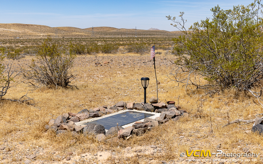 Bell X‑2 memorial in the Kramer Hills.
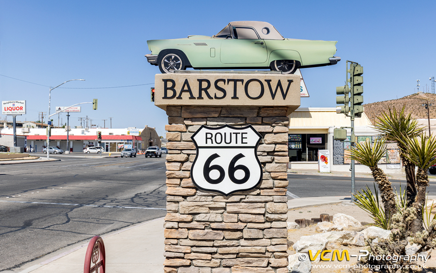 Barstow city limits road sign.
Sunday 17th ‑ Today was my second attempt to find the crash site of the North American XB‑70 Valkyrie which crashed in the Mud Hills north of Barstow after a mid‑air collision with a Lockheed F‑104 Starfighter (flown by NASA Chief Research test Pilot Joseph A. Walker) during a publicity photo formation flight for the engine manufacturer, General Electric. In my attempt to find the crash site in May 2025 I had printed off Google Earth screen shots and marked my intended route on them, following what I considered the most distinctive OHV routes through the desert. In reality the OHV tracks were not as easy to follow in the field as envisaged and at some point I took a wrong turn, or followed the wrong track and lost my bearings. Over the past year I had studied Google Earth and viewed online dashcam videos by people who had visited the crash site and deduced where I had gone wrong. On this visit my preparation paid off and we easily found the crash site, and without the need of a GPS which I had brought along as a backup. After visiting the site I could see where I had gone wrong the previous year and realised that I had passed within a hundred metres of it. So near, yet so far.
 North American XB‑70A Valkyrie crash site memorial in the Mud Hills, north of Barstow.
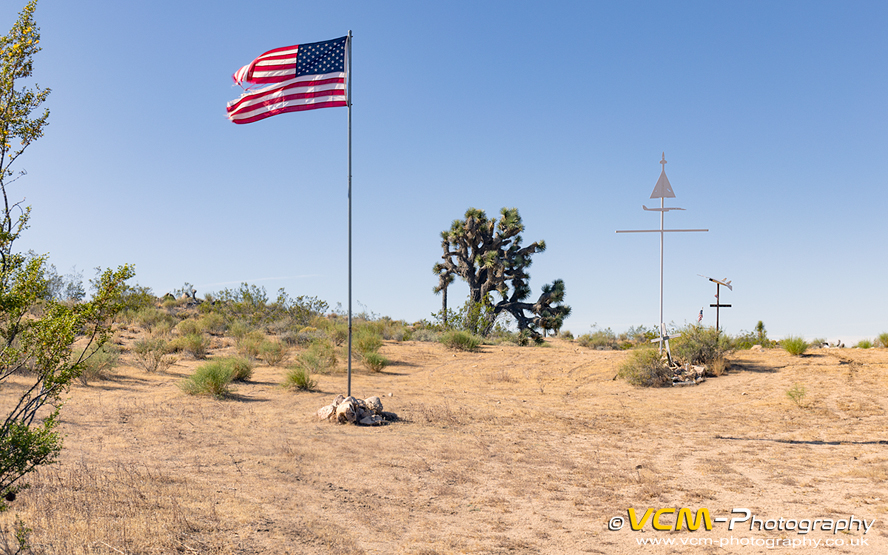
After visiting the Valkyrie we travelled back to Barstow, then along Highway 58 past Kramer Junction towards Mojave. Approximately eight miles before Mojave we turned off the highway and took a OHV track to the east into the Mojave Desert to the Glen Edwards memorial and crash site of the Northrop YB‑49 “Flying Wing” bomber. The site features a metal plaque with the names of the five crew members who perished in the crash, an American flag and a military flag, the latter which I think had been erected recently. By now the weather had changed and the winds had picked up, so much so, I couldn't get sharp photos of the memorial because it was vibrating in the wind. We would be passing the area on our way back to Los Angeles so I was determined to return when hopefully the winds had died down. Leaving the site we made our way back onto the highway and travelled onto Mojave where we had lunch before heading north to Lone Pine where we had accommodation booked for the next two nights.
 Glen Edwards memorial and Northrop YB‑49 crash site in the Mojave Desert north of Edwards Air Force Base.
Monday 18th ‑ In June 1972 two McDonnell Douglas F‑4J Phantoms from VFA‑154 “Black Knights” whilst on a
training flight collided over the Coso Range (north of N.A.W.S. China Lake) with wreckage being scattered over a wide area. There is a
substantial amount of wreckage remaining from the two aircraft, such as a tail section, outer wing section and inner wing section with the
undercarriage leg and wheel still attached. Looking at photos and videos online by people who had visited the sites I had a pretty good idea
where some of the wreckage was located. Joe Idoni, an aircraft wreck hunter from California was most helpful in confirming the locations of the
main items and also supplying the locations of other bits of wreckage I was unaware of. Many thanks for your help Joe and I recommend taking a look at
Joe Idoni Aircraft Crash Sites.
To access the crash site entailed a five‑mile drive from California State
Route 190 on a OHV track called the Centennial Road whose surface was generally hard‑packed, but had sections which were deeply rutted and
littered with large stones, so I was thankful for having a Jeep Wrangler.
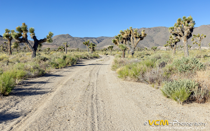 A section of the Centennial Road leading to the Coso Range.
From where we parked the jeep we had over a three‑mile trek to the wreckage on desert tracks which had large sections eroded or completely washed away, I assume by flash floods. I know of people who have accessed the crash site by driving on these tracks, but I assume this was when the tracks were in a better condition, because I certainly would not have attempted it, especially in a vehicle whose limitations I was unfamiliar with. Better to be safe than sorry, so we used “Shanksies Pony” ie. walked. For the full story and photos of our trip to the Coso Range (when uploaded) see my report in the Air Crash Sites section.
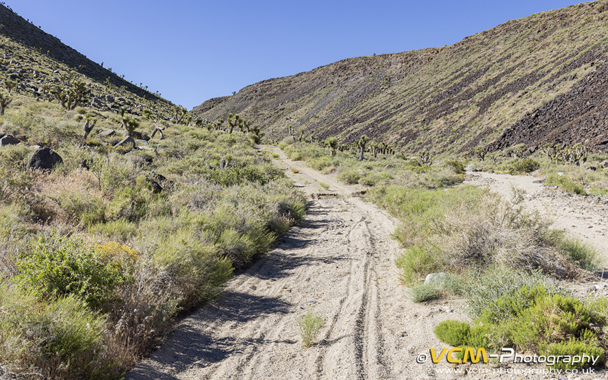 A section of the desert track in the Coso Range leading to the wreckage of the F‑4J Phantoms.
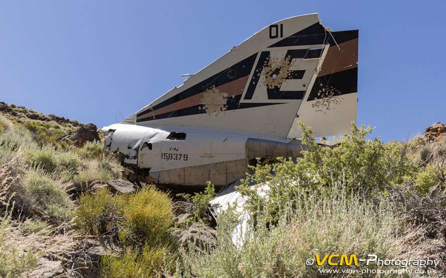 Tail section off one the F‑4J Phantoms in the Coso Range.
Tuesday 19th ‑ Today I had planned on doing some military low flying aircraft photography at Haystack (or Point Delta), a hill in the Owens Valley on the Sidewinder military low‑level training route, but decided instead to have a leisurely day and make our way down to Kernville where we were spending the remainder of our vacation. Driving from Lone Pine to Kernville we went via Ridgecrest to stop for lunch at our favourite American style diner, Denny's and to visit the China Lake Air Museum on Las Flores Avenue. The museum which moved to its current location from N.A.W.S. China Lake in March 2018 is currently undergoing an expansion. The aircraft exhibits are visible but cordoned off from the public while the grounds are being prepared for the arrival of the remaining aircraft still located on the Naval Air Weapons Station. A new addition to the museum is a McDonnell Douglas AV‑8B Harrier which was retired in September 2025 and transported by road from the nearby air base to the museum in December 2025. The Harrier on display, BuNo. 164129 ‘DD‑88’ is the same aircraft I was lucky to photograph in the Kern River Valley in May 2025.
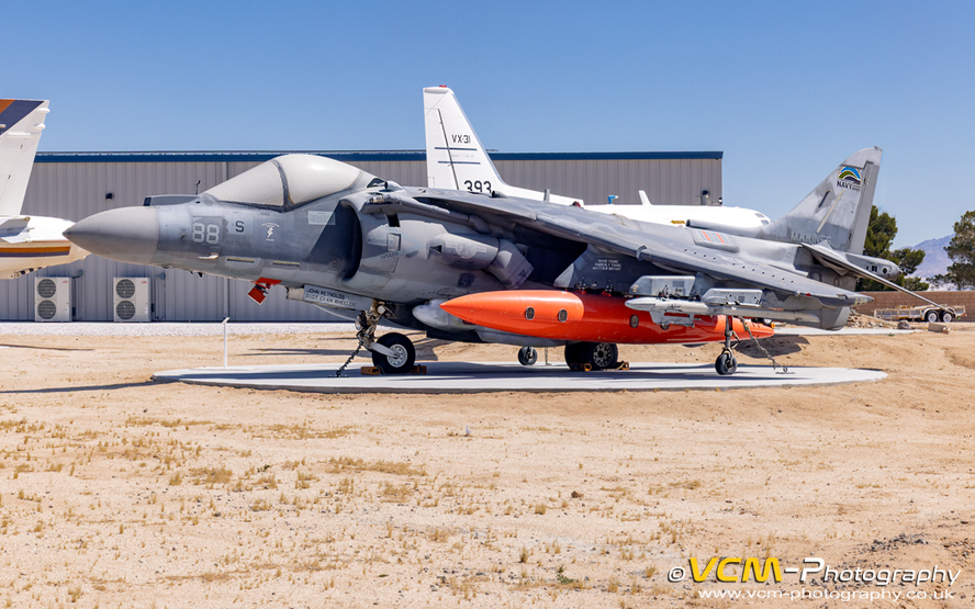 Latest addition to the China Lake Air Museum, a McDonnell Douglas AV‑8B Harrier II (BuNo. 164129 ‘DD‑88’).
After visiting the museum we left Ridgecrest and travelled over the Walker Pass to Kernville where we had three nights
booked at the Whispering Pines Lodge.
Wednesday 20th ‑ My wife decided to stay in Kernville and have a leisurely day while I climbed up the hill overlooking the
Calkins Flat Dispersed Area to hopefully photograph low flying military aircraft using the Sidewinder low‑level training route. I climbed the
hill and was in position ready and waiting by 08:10. The first aircraft to appear at 09:35 which was not landlocked (ie. passed high)
was a Lockheed Martin F‑35C Lightning II (BuNo. 169305 ‘NH‑301’) of VFA‑86 “Sidewinders” Strike Fighter
Squadron from N.A.S. Lemoore. The F‑35C was followed at 09:46 by an F/A‑18F Super Hornet (BuNo. 166962 ‘NE‑106’)
of VFA‑2“ Bounty Hunters” Strike Fighter Squadron from N.A.S. Lemoore which did a nice low pass.
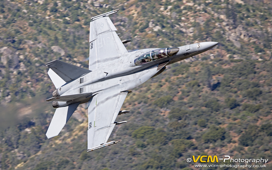 F/A‑18F Super Hornet (BuNo. 166962 ‘NE‑106’) of VFA‑2 “Bounty Hunters”.
At 10:16 two F‑16's of the USAF 64th Aggressor Squadron from Nellis
Air Force Base appeared, but were high. The lead aircraft (S/N. 87‑0292 ‘WA’) was painted in a “Blizzard”
(Arctic) colour scheme. At 10:46 a Sikorsky MH‑60S Knighthawk (BuNo. 166297 ‘DD‑365’) of VX‑31
“Dust Devils” Air & Test Evaluation Squadron from N.A.W.S. China Lake approached from the north flying very low following the
course of the river. Unfortunately I had no keepable photos due to my lack of slow panning practise this year. The remaining aircraft seen were high
apart form an RAF F‑35B Lightning, ZM170 ‘036’ from Edwards Air Force Base which appeared at 12:47 followed by the familiar sight
of the retro gloss‑black painted “Vandi 1” F/A‑18F Super Hornet (BuNo. 166673 ‘XE’) of VX‑9
“Vampires” which appeared at 13:41. I left the hill at 15:15.
Thursday 21st ‑ Today I tried a new location overlooking the Fairview Helispot/Shooting Range. I spent nearly an hour wandering
around the hillside which was covered in thick vegetation looking for a suitable location. I eventually found a flat rocky area which gave me a clear
view of any approaching aircraft and was ready for any action by 08:15. The only problem with this location was that the hill was not as high above
the valley floor than other locations, and I was concerned that any aircraft seen would be too high and not landlocked.
 View from the photography location above the Fairview Helispot in the Kern River Valley.
My concern was soon dispelled when a Lockheed Martin F‑35C Lightning II (BuNo. 169600 ‘NH‑304’) of VFA‑86 “Sidewinders” Strike Fighter Squadron from N.A.S. Lemoore appeared at 08:57 and passed me at eye level, fully landlocked. At 09:00 the quiet was broken by the sound of gunshots for the next hour as a group of people used the firing range down below me. At least it kept me entertained between aircraft passes.
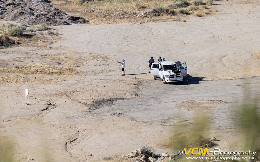 Fairview Helispot shooting range in the Kern River Valley.
At 09:11 and 09:54 a Boeing B‑52H Stratofortress (S/N. 60‑0031 ‘OT’) of the USAF 49th Test & Evaluation Squadron from Barksdale Air Force Base Louisiana passed high overhead at approximately 2000ft A.G.L. following the route of the valley. Due to my location the majority of aircraft passed high and I have not included them in this report.
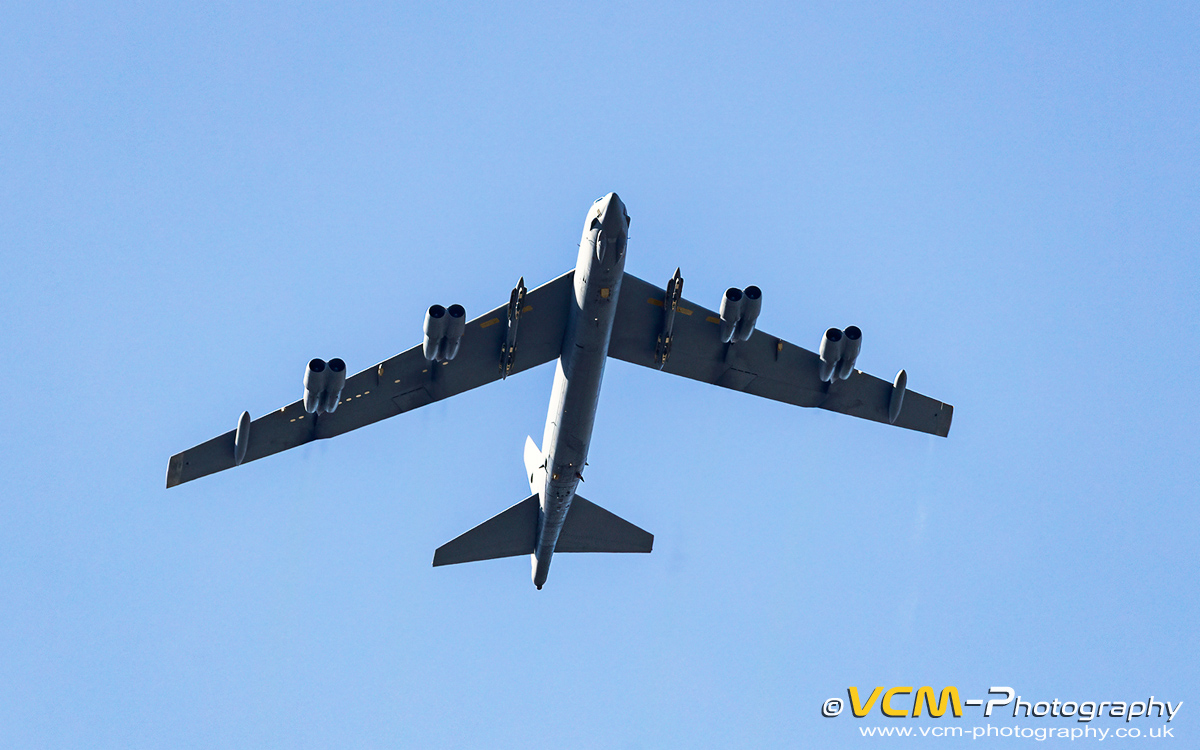 Second of two passes by a B‑52 Stratofortress of the USAF 49th Test & Evaluation Squadron.
At 12:28 two F‑15E Strike Eagles from the USAF 422nd Test & Evaluation Squadron, Nellis Air Force Base dropped into the valley. The first
aircraft whose serial I could not see passed high but dropped lower going into the turn at Calkins Flat, then powered of of the valley using its afterburners.
The second F‑15E (S/N. 91‑0325 ‘OT’) passed me lower than eye level ‑ very impressive. Another first seen
in the valley by myself at 13:10 was a Boeing C‑17A Globemaster III, (S/N. 03‑3121 ‘ED’) of the USAF 412nd
Test Wing/418th Flight Test Squadron from Nellis Air Force Base. The aircraft was high as it passed my location but I managed to photograph it landlocked
as it made the turn at Calkins Flat. I left the hill at 14:40.
Photographs from my trip can be viewed at:
2026 ‑ Sidewinder USA Military Low Flying.
Friday 22nd ‑ Today we planned to make oor way back to Palmdale where we had a hotel booked for the night. I was planning on visiting
the site of the B‑24 Liberator, S/N. 42‑50780 located in the Mojave Desert north of Boron, which I didn't have time to visit last
Saturday. The crash site is approximately four miles off Highway 395 along OHV routes. As we were returning to Los Angeles the following morning and
I didn't know the condition of the OHV routes I was reluctant to push my luck and visit the site in case we had any issues with our vehicle, ie.
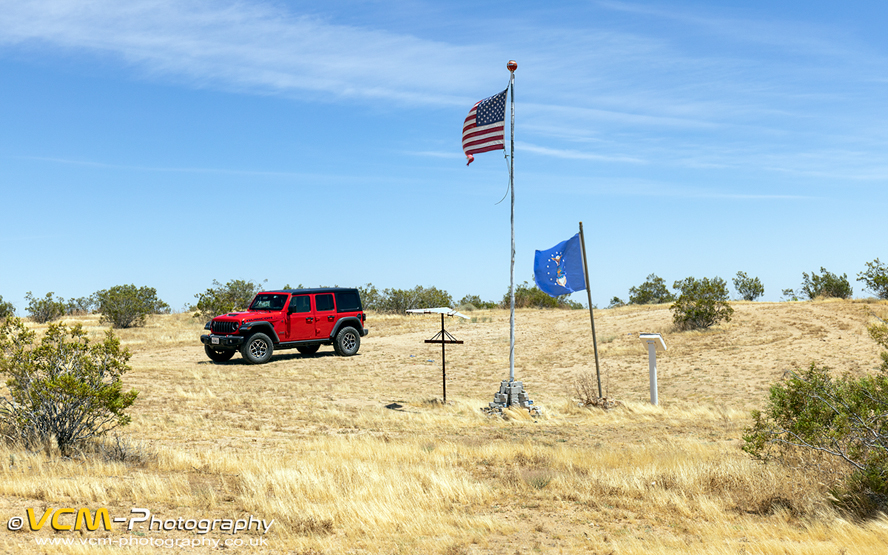
breaking down or getting stuck, since time would be an issue. As promised, I made a return visit to the Glen Edwards Memorial and Northrop YB‑49
“Flying Wing” bomber crash site, as I knew the condition of the OHV tracks and the winds had died down. The winds must have been strong,
because when we arrived at the memorial to find the American flag lying on the ground. We tried to attach it back to the pole, but the connecting
links were broken. After leaving the site we made our way to Palmdale where we made another visit to the Blackbird Airpark and the Joe Davies
Heritage Airpark.
Saturday 23rd ‑ Today we returned the Jeep Wrangler to the car hire centre in Los Angeles and caught the shuttle bus to LAX for the
afternoon departure of our return flight to the U.K.