To Contact Me
On Friday 20th May after more than a two‑year hiatus due to the COVID‑19 pandemic
I finally boarded an international flight to California, USA, in the anticipation of some military low flying photography.
Due to the F/A‑18E Super Hornet crash on the 31st July 2019 at Rainbow Canyon in which Navy pilot Lieutenant Commander
Charles Z. Walker was killed, the Jedi Transition route and more specifically the canyon has an enforced height restriction of
2000ft AGL which has more‑or‑less scuttled the opportunity of photographing any aircraft low‑level in that area.
The Jedi Transition is only a part of the much larger Sidewinder military low flying route, so the aim was to explore and try out new
locations.
Monday 23rd - Marble Canyon, Inyo County, which is located within the northern section of the Sidewinder
(between Waypoints E and F. The canyon is located
in a remote hot desert area, with the last six miles accessed by a unpaved gravel road. There is no phone reception and the journey should
only be attempted ideally with a 4x4 vehicle. I did the journey in a normal hire car, something in retrospect I would not attempt again.
It took one hour both ways to drive the six miles, taking great care not to damage or puncture the tyres. Luck was on my
side ‘This Time’ so I only visited for the one day.
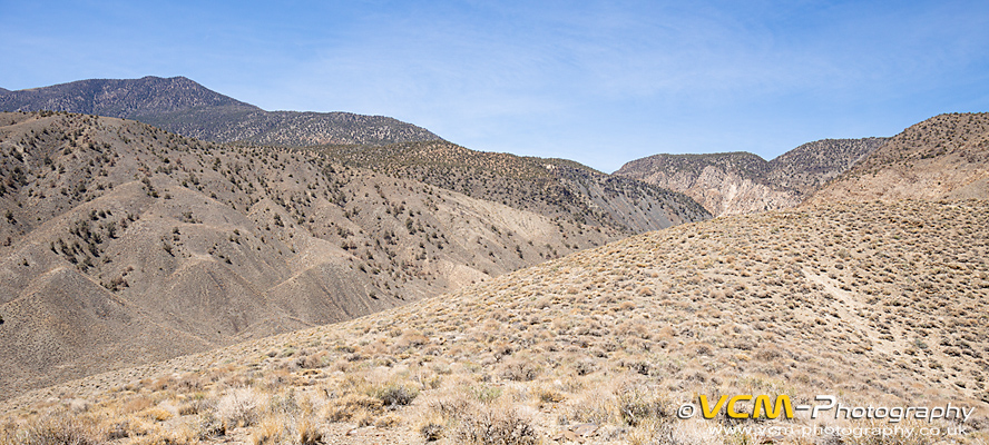 Marble Canyon looking west towards the direction of aircraft approach.
A local photographer I know through social media has tried the canyon a number of times with mixed results. The canyon is not
deep like Rainbow Canyon so aircraft can tend to be high (not landlocked) if you are not in a suitable location. For myself
this visit was more exploratory to see if it had potential, so I did not push my luck by venturing too far down the canyon, due to the high
temperatures and road conditions. Throughout the day there was approximately fifteen to twenty aircraft passes, with the majority of the
aircraft passing overhead or routing past to the north of my location. Possible vantage points were noted which could be explored another
time in the cooler months with a more suitable vehicle.
Tuesday 24th to Friday 27th - Kern River Valley. A valley and region of the Southern Sierra Nevada and start of the Sidewinder military
low flying route (between Waypoints A and B). Several
locations were tried over the four days with mixed results. The Kern River Valley runs north to south with the locations I tried on the
east side of the river off the Mountain Highway 99. The sun can be an issue after midday as you will be facing into the light, which is not
ideal for photography. Changing over to the west side of the river in the afternoon is not an option as the river can be deep and fast flowing,
with only one footbridge located fourteen miles north of the town of Kernville. Several possible photography locations were identified by studying
topographic maps and Google Earth, but only two to three were suitable. The climb at these locations was a lot harder than anticipated, partly due
to the high temperatures (+90°F by early afternoon), but also the ground conditions, where hard compact dry sand gave no grip on
the relatively steep slopes. In some areas thick vegetation also hindered access. Future possible vantage points were noted on both sides of the
river for exploration on another trip.
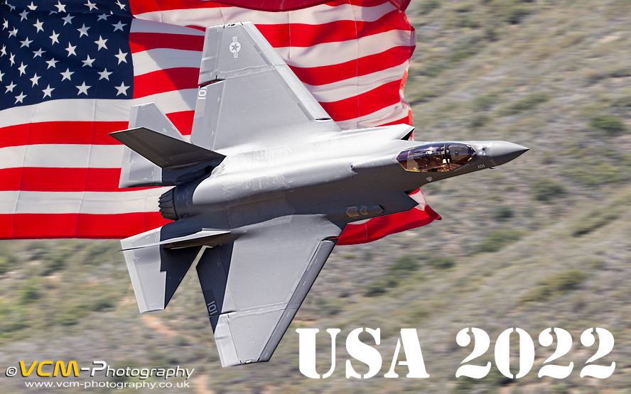 U.S. Navy F-35C Lightning II routing low-level through the Kern River Valley, California.
In the Kern River Valley I was treated to several aircraft passes, with a 50/50 ratio of high passes to low‑level passes
where they were landlocked. Notable captures: ‑ Four‑ship of F‑35A Lightning II's from Luke A.F.B. Arizona.
F‑35C Lightning II's from N.A.W.S. China Lake. Numerous Super Hornets from N.A.S. Leemore and a privately owned T‑38A Talon flying
from Mojave.
Photographs from my trip can be viewed at:
2022 ‑ Sidewinder Trip 1, USA Military Low Flying.